
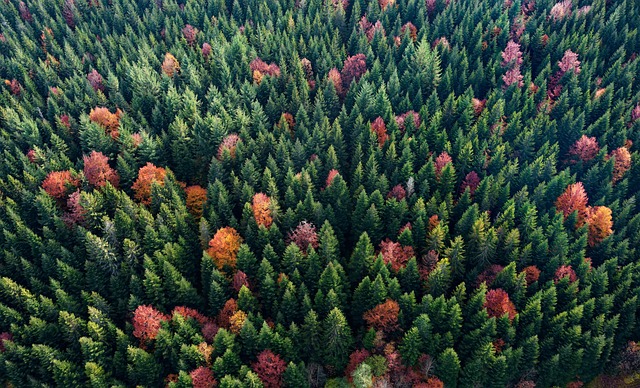
Greek Researchers Develop First National Satellite Forest Monitoring System
In a significant advancement for forest conservation, Greek researchers have created the first national satellite forest monitoring system. This system integrates data from various satellite sources to provide comprehensive and real-time monitoring of forest health and changes across Greece. The development is particularly notable for its potential to enhance national forest management strategies and contribute to global forest conservation efforts.
System Capabilities and Data Integration
The Greek satellite forest monitoring system leverages high-resolution optical imagery from satellites like Sentinel-2, radar data from Sentinel-1, and LiDAR measurements from ICESat-2. By combining these diverse data sources, the system can deliver detailed insights into forest structure, biomass, and canopy height. The integration of multi-spectral and radar data allows for more accurate detection of forest disturbances, such as illegal logging and wildfires, even in cloud-covered regions.
One of the system's core components is its use of machine learning algorithms to classify forest types and monitor changes over time. Researchers have trained these algorithms using historical satellite data and ground truth measurements, enabling the system to automatically identify and track forest areas undergoing significant changes. This capability is crucial for timely intervention and management.
Implications for Forest Conservation
The implementation of this national monitoring system has several important implications for forest conservation in Greece and beyond. Firstly, it provides forest managers with actionable data to make informed decisions about resource allocation and conservation priorities. The system's near-real-time monitoring capabilities allow for rapid response to emerging threats, such as illegal logging or forest fires.
Additionally, the data generated by the system can contribute to global forest monitoring initiatives, such as the Global Forest Watch. By sharing their findings and methodologies, Greek researchers can support international efforts to combat deforestation and promote sustainable forest management. This collaboration is essential for addressing the global challenge of forest loss and its impacts on biodiversity and climate change.
From ihugtrees.org's perspective, this development underscores the value of integrating diverse satellite data sources for comprehensive forest monitoring. Our own work in urban tree canopy mapping and desert greening projects similarly relies on the fusion of optical, radar, and LiDAR data to obtain accurate and timely information. The Greek system's success demonstrates the potential of national-scale satellite monitoring to drive effective conservation actions.
As Greece continues to refine and expand its satellite forest monitoring system, it sets a precedent for other nations to follow. The integration of advanced remote sensing technologies with machine learning offers a powerful tool for protecting and managing forests in an era of increasing environmental challenges.