I Hug Trees

Satellite Monitoring & Remote Sensing

Tree Conservation from Space – Weekly

Tracking forests, urban trees, and carbon from orbit — weekly insights on remote sensing and satellite analytics for tree conservation.

📅 2026-07-11 ⏱️ 14 min read 🛰️ Weekly

Week of 2026-07-11

Satellite Monitoring & Remote Sensing

Tracking forests, urban trees, and carbon from orbit — weekly insights on remote sensing and satellite analytics for tree conservation.

This Week's Highlights

In the realm of tree conservation, satellite data and remote sensing emerge as pivotal tools, offering unprecedented insights into forest health, carbon stocks, and biodiversity. This week, we delve into groundbreaking developments: a Florida State University researcher employs NASA satellite data to uncover global patterns in tropical forest canopy height, while Planet satellite data aids in monitoring tropical forest carbon stocks and emissions. Additionally, an innovative fusion of satellite and UAV analyses quantifies carbon stock and tree community composition in tropical forests. These advancements underscore the critical themes of this edition: the integration of AI with satellite data for urban tree monitoring, the establishment of national satellite forest monitoring systems, and the use of satellite deforestation data for rural credit verification. At ihugtrees.org, we track these developments not merely as observers, but as practitioners committed to leveraging satellite monitoring and remote sensing for urban trees and desert greening. This digest serves as a curated glimpse into the cutting-edge applications and research shaping the future of tree conservation.

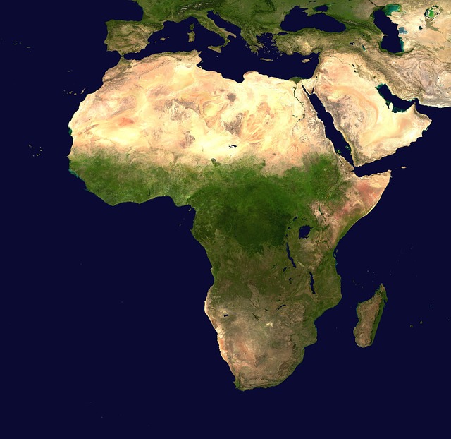
Satellite monitoring of forest canopy from orbit

Satellite monitoring of global forest canopy. Photo: I Hug Trees / ihugtrees.org

Understanding Satellite Monitoring for Tree Conservation

What is Satellite Remote Sensing and Why Does It Matter for Trees?

Satellite remote sensing is the science of measuring and monitoring Earth's surface from orbit — without physically visiting the location. For tree conservation, this capability is transformative. Satellites equipped with optical, multispectral, radar, and LiDAR sensors can measure forest extent, tree canopy density, vegetation health, above-ground biomass, and carbon stocks across millions of hectares simultaneously. Indices like NDVI (Normalized Difference Vegetation Index) turn raw spectral data into actionable insights: is this forest stressed? Is it losing cover? Is that reforestation project actually working?

The stakes are high. Forests cover roughly 31% of Earth's land area and store approximately 560 billion tonnes of carbon. Monitoring them at scale is impossible through ground surveys alone. Satellite data from platforms like NASA's Landsat and MODIS, ESA's Sentinel constellation, and commercial providers such as Planet Labs now makes near-real-time global forest monitoring a reality. At ihugtrees.org, we apply these tools directly — tracking urban tree canopy change and monitoring desert greening outcomes through satellite data analytics.

How Do Satellites Monitor Trees — and What Can the Data Tell Us?

Different sensors reveal different dimensions of forest health. Optical satellites capture reflected sunlight to map tree cover, detect species composition, and compute vegetation indices. Synthetic Aperture Radar (SAR) penetrates cloud cover — critical in tropical regions — and measures forest structure and biomass. LiDAR instruments like NASA's GEDI mission fire laser pulses to reconstruct precise 3D canopy architecture, enabling accurate carbon stock estimates at global scale. Combined with AI and machine learning, these data streams power automatic deforestation alerts, urban canopy inventories, and restoration verification systems.

The analytical layer is equally important. Platforms like Google Earth Engine allow scientists and conservationists to process petabytes of satellite imagery in the cloud without specialised hardware. Open-source tools such as QGIS, SNAP, and Python-based libraries democratise access further. The result: a growing community of practitioners — including community organisations, NGOs, and platforms like ihugtrees.org — can now deploy satellite analytics for local conservation action, not just large institutions. This weekly digest tracks the frontier of that expanding capability.

NDVI & Forest Health Monitoring

Satellite NDVI image showing forest health and vegetation density

Photo by pasja1000 on Pixabay

The Normalized Difference Vegetation Index (NDVI) is a powerful tool for assessing forest health, leveraging satellite data from platforms like Sentinel-2 and Landsat to detect vegetation stress and monitor seasonal changes[1]. By analyzing the contrast between near-infrared and red light reflected by vegetation, NDVI provides critical insights into the vitality of forest ecosystems[2]. This method is particularly effective in identifying areas of tree health decline, enabling targeted interventions to mitigate issues such as disease, pest infestations, or the impacts of climate change[3].

Sentinel-2 and Landsat satellites offer high-resolution imagery that allows for precise monitoring of forest conditions over time[4]. These satellites capture data that, when processed through NDVI analysis, reveal patterns of vegetation stress and recovery, facilitating early detection of potential threats to forest health[5]. This capability is crucial for implementing timely management strategies to preserve forest ecosystems and their biodiversity.

In summary, NDVI analysis, supported by Sentinel-2 and Landsat data, plays a vital role in forest health monitoring. It enables the detection of vegetation stress, tracks seasonal changes, and aids in the assessment of tree health from space, contributing to the sustainable management of global forest resources.
Deforestation Detection & Alerts

Satellite imagery detecting deforestation and forest loss

Photo by mmisof on Pixabay

Real-time deforestation alerts are crucial for monitoring and mitigating forest cover loss, particularly in tropical regions like the Amazon. Satellite systems such as PRODES and DETER provide detailed data on deforestation rates, enabling timely interventions[1]. Global Forest Watch (GFW) offers an accessible platform for visualizing these changes, facilitating global awareness and action[2]. By integrating data from various sources, GFW enhances the detection of illegal logging activities and supports evidence-based policy decisions[3].

The PRODES and DETER systems are instrumental in quantifying forest cover loss, with PRODES providing annual deforestation rates and DETER offering near-real-time alerts[4]. These tools are essential for tracking deforestation trends and evaluating the effectiveness of conservation efforts[5]. Additionally, the proposed legislation in Brazil to ban certain satellite tools highlights the political challenges in deforestation monitoring, underscoring the need for robust, internationally supported systems[3][4].

Effective deforestation detection and alert systems require continuous technological advancements and international collaboration. By leveraging satellite data and platforms like GFW, stakeholders can better address the complex issue of deforestation, promoting sustainable forest management and conservation globally[2][5].

Urban Tree Canopy Mapping

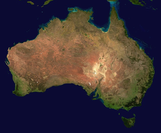
Aerial view of urban tree canopy and city green cover

Photo by WikiImages on Pixabay

Urban tree canopy mapping leverages aerial and satellite imagery to assess green cover at city levels, offering critical insights into urban ecosystems[1]. This process involves detailed street tree inventories using Geographic Information Systems (GIS) and artificial intelligence (AI) to enhance accuracy and efficiency[4]. These technologies enable cities to identify areas with insufficient tree coverage, crucial for mitigating the urban heat island effect[5]. Organizations like ihugtrees.org exemplify this approach by actively monitoring urban trees, utilizing advanced data analytics to promote green urban planning and environmental stewardship.

The integration of satellite data with UAV analyses allows for a comprehensive evaluation of tree community composition and carbon stock in urban environments[2]. This dual approach not only enhances the precision of urban tree canopy maps but also supports informed decision-making in urban planning and environmental conservation[3]. By employing these cutting-edge technologies, cities can better manage their green spaces, ensuring they contribute effectively to urban cooling and biodiversity enhancement.

Furthermore, the application of AI in analyzing satellite imagery accelerates the process of urban tree canopy mapping, allowing for real-time updates and more dynamic urban planning strategies[4]. This technological advancement ensures that urban green spaces are not only preserved but also expanded in a manner that addresses current and future environmental challenges, highlighting the critical role of technology in sustainable urban development.

LiDAR & 3D Forest Structure

LiDAR 3D point cloud map of forest structure and canopy height

Photo by pasja1000 on Pixabay

Airborne and spaceborne LiDAR technologies have revolutionized our understanding of 3D forest structure. NASA's GEDI mission, utilizing spaceborne LiDAR, has provided unprecedented insights into global forest canopy heights and biomass[1]. By generating detailed canopy height models and 3D point clouds, GEDI data enables precise above-ground biomass estimation[3]. This is crucial for carbon stock quantification and climate change mitigation strategies. Drone LiDAR surveys complement these efforts by offering high-resolution, localized data that enhance the accuracy of forest structure analyses[2]. Combining satellite and UAV data allows for a comprehensive assessment of forest carbon stocks and tree community composition, facilitating better forest management and conservation practices[4].

The integration of multimodal remote sensing observations with machine learning further refines above-ground biomass estimations in mixed temperate forests[4]. This approach leverages the strengths of both LiDAR and optical data, providing a more robust framework for forest monitoring. The use of large datasets of labelled single tree point clouds and quantitative structure models (QSMs) enhances our ability to analyze individual tree contributions to overall forest biomass[5]. These advancements in LiDAR technology and data analysis are pivotal for developing effective forest conservation strategies and understanding the complexities of forest ecosystems on a global scale.

Carbon Stock Assessment

Forest carbon stock measurement using satellite remote sensing

Photo by WikiImages on Pixabay

Satellite-based forest carbon stock estimation has revolutionized REDD+ monitoring and verification, offering precise above-ground biomass mapping[1]. Utilizing advanced remote sensing technologies, researchers can now measure carbon credits from orbit[2], providing critical data for national forest inventories[3]. This approach enhances our understanding of forest carbon dynamics, enabling more effective climate change mitigation strategies. By integrating satellite data with UAV analyses, scientists achieve higher accuracy in quantifying carbon stock and tree community composition in tropical forests[4]. This synergy between satellite and UAV technologies ensures robust, scalable solutions for global forest carbon assessments.

National forest inventories using remote sensing play a pivotal role in carbon stock assessment, offering detailed insights into biomass distribution and carbon storage[5]. These inventories are essential for implementing REDD+ initiatives, as they provide the necessary data to monitor deforestation and forest degradation[1]. The integration of satellite data allows for continuous, large-scale monitoring, which is crucial for verifying carbon credit claims and ensuring compliance with international standards[2]. This comprehensive approach supports sustainable forest management and contributes to global efforts in reducing carbon emissions.

Biodiversity & Habitat Monitoring

Biodiversity and habitat monitoring have been revolutionized by satellite technology, allowing for unprecedented insights into species habitat mapping[1]. Forest fragmentation analysis[4] and protected area monitoring[3] are now more precise, thanks to satellite data. Ecosystem diversity assessments from space[2] provide critical information for conservation efforts, highlighting areas of high biodiversity value and potential threats.

Connectivity corridors detection[3] is another vital application, ensuring safe passage for wildlife between fragmented habitats. This technology aids in the creation of wildlife corridors, which are essential for maintaining genetic diversity and species survival[3]. Satellite data also facilitates the monitoring of protected areas, ensuring that conservation efforts are effective and that habitats are preserved for future generations[5].

The integration of satellite monitoring systems, like the one developed by Greek researchers[1], offers a comprehensive approach to biodiversity conservation. By leveraging dynamic habitat indices[2] and advanced satellite imagery, conservationists can make informed decisions, prioritize areas for protection, and implement strategies that enhance ecosystem resilience and connectivity[3].

Reforestation & Restoration Tracking

Satellite tracking of reforestation and forest restoration progress

Photo by jplenio on Pixabay

Reforestation and restoration tracking have become pivotal in global efforts to combat deforestation and climate change. Satellite verification of tree planting and reforestation success is now more accurate than ever, thanks to advancements in machine learning and big data analytics[1]. For instance, the Bonn Challenge, which aims to restore 350 million hectares of deforested and degraded land by 2030, relies heavily on satellite monitoring to track progress[5]. Restoration site tracking over time allows for the assessment of afforestation performance, ensuring that newly planted trees are thriving and contributing to carbon sequestration[4]. Organizations like ihugtrees.org utilize satellite analytics to monitor desert greening initiatives, providing valuable data on the effectiveness of these projects[3].

The use of satellite technology in reforestation efforts extends beyond mere tracking; it offers detailed insights into the health and growth of restored ecosystems. For example, satellite imagery can distinguish between palm oil plantations and native rainforests by analyzing the angle at which sunlight is bent by tree fronds[2]. This level of precision enables more effective management and protection of restored areas. Additionally, satellite data helps identify areas where reforestation efforts are most needed, particularly in regions where nearly 30% of tree cover exists outside traditional forest boundaries[3]. This comprehensive approach ensures that restoration projects are both targeted and successful, contributing to global biodiversity and climate goals.

Data Analytics Tools & Platforms

Data analytics dashboard for satellite forest monitoring

Photo by WikiImages on Pixabay

Data analytics tools and platforms are revolutionizing forest conservation and management. Google Earth Engine provides a robust platform for processing and analyzing satellite data, enabling detailed forest classification and monitoring[1]. Open-source GIS tools, such as QGIS, offer accessible solutions for spatial data analysis, supporting conservation efforts globally[2]. Machine learning techniques, particularly deep learning, have proven effective in classifying forest types and detecting individual trees from satellite imagery[3][5]. Cloud-based satellite data platforms facilitate real-time access to vast amounts of remote sensing data, enhancing the ability to monitor forest health and changes over time[4].

AI-driven tree detection algorithms are increasingly used to identify and count trees in urban and natural environments, providing critical data for urban planning and biodiversity conservation[3]. These technologies leverage high-resolution satellite and UAV imagery to deliver precise tree detection and species classification[5]. Moreover, accessible remote sensing analytics are democratizing forest monitoring, allowing conservationists and researchers to utilize advanced tools without extensive technical expertise. This shift is crucial for enhancing global forest conservation efforts and ensuring sustainable management practices.

Thank you for reading this week's Satellite Monitoring & Remote Sensing digest from ihugtrees.org. Every pixel of satellite data brings us closer to understanding — and protecting — the world's trees. We'll return next week with more insights from orbit, from the field, and from the data.

📚 Referenced Sources

NDVI & Forest Health Monitoring

  1. FSU researcher uses NASA satellite data to reveal global patterns in tropical forest canopy height - Florida State University News (2026-07-11)
  2. Monitoring tropical forest carbon stocks and emissions using Planet satellite data | Scientific Reports - Nature (2026-07-11)
  3. Quantifying carbon stock and tree community composition in tropical forests through combining satellite and UAV analyses | Scientific Reports - Nature (2026-07-11)
  4. Quantifying carbon stock and tree community composition in tropical forests through combining satellite and UAV analyses | Scientific Reports - Nature (2026-07-11)
  5. Digital forestry team combines AI with satellite data to monitor urban trees - Purdue University - College of Agriculture (2026-07-11)

Deforestation Detection & Alerts

  1. Brazilian banks to verify satellite deforestation data for rural credit - AP News (2026-07-11)
  2. Harnessing the Power of Global Forest Watch for Data-Driven Reporting on Land Cover Change - Global Investigative Journalism Network (GIJN) (2026-07-11)
  3. Brazil bill aims to ban satellite tool used to slow Amazon deforestation - news - Mongabay (2026-07-11)
  4. Brazil Congress passes bill to bar use of Amazon deforestation satellite tool - news - Mongabay (2026-07-11)
  5. A near-real-time tropical deforestation monitoring algorithm based on the CuSum change detection method - Frontiers (2026-07-11)

Urban Tree Canopy Mapping

  1. FSU researcher uses NASA satellite data to reveal global patterns in tropical forest canopy height - Florida State University News (2026-07-11)
  2. Quantifying carbon stock and tree community composition in tropical forests through combining satellite and UAV analyses | Scientific Reports - Nature (2026-07-11)
  3. Quantifying carbon stock and tree community composition in tropical forests through combining satellite and UAV analyses | Scientific Reports - Nature (2026-07-11)
  4. Digital forestry team combines AI with satellite data to monitor urban trees - Purdue University - College of Agriculture (2026-07-11)
  5. Austin uses satellite data to find gaps in its tree canopy - Planetizen (2026-07-11)

LiDAR & 3D Forest Structure

  1. FSU researcher uses NASA satellite data to reveal global patterns in tropical forest canopy height - Florida State University News (2026-07-11)
  2. Quantifying carbon stock and tree community composition in tropical forests through combining satellite and UAV analyses | Scientific Reports - Nature (2026-07-11)
  3. DART 3D Radiative Transfer Modeling Applied to RAMI Forests – Part 2: Lidar Waveform Simulation and Canopy Structure Analysis - Science Partner Journals (2026-07-11)
  4. Aboveground biomass estimation using multimodal remote sensing observations and machine learning in mixed temperate forest - Nature (2026-07-11)
  5. A large dataset of labelled single tree point clouds, QSMs and tree graphs - Nature (2026-07-11)

Carbon Stock Assessment

  1. Monitoring tropical forest carbon stocks and emissions using Planet satellite data | Scientific Reports - Nature (2026-07-11)
  2. Quantifying carbon stock and tree community composition in tropical forests through combining satellite and UAV analyses | Scientific Reports - Nature (2026-07-11)
  3. Quantifying carbon stock and tree community composition in tropical forests through combining satellite and UAV analyses | Scientific Reports - Nature (2026-07-11)
  4. Tree structural modeling from leaf-on point clouds for biomass carbon stock estimation - Nature (2026-07-11)
  5. Assessment of biomass and carbon stock in subtropical Sal ( Shorea robusta Gaertn. f.) forests in the North Western Himalayas - Nature (2026-07-11)

Biodiversity & Habitat Monitoring

  1. Greek Researchers Create First National Satellite Forest Monitoring System - GreekReporter.com (2026-07-11)
  2. Bridging Satellite Productivity and Global Biodiversity: Unveiling Insights through Dynamic Habitat Indices - Science Partner Journals (2026-07-11)
  3. Sample Grant Proposal on “Wildlife Corridor Mapping Using Satellite Data for Global Biodiversity Connectivity” - fundsforNGOs (2026-07-11)
  4. Karbi Anglong loses 12% forest cover between 2001–2020: Satellite study - The Assam Tribune (2026-07-11)
  5. Copernicus Data Space Ecosystem establishes public cloud processing for earth observation data - Nature (2026-07-11)

Reforestation & Restoration Tracking

  1. Big data, machine learning shed light on Asian reforestation successes - Purdue University (2026-07-11)
  2. Satellites can now tell a palm oil plantation from native rainforest by the precise angle its fronds bend the sunlight, reading the near-perfect planted lattice against the chaos of wild canopy — and the European Union's 2023 deforestation regulation now leans o - Space Daily (2026-07-11)
  3. Nearly 30% of all tree cover in Africa may be outside of forests, study says - news - Mongabay (2026-07-11)
  4. AI and Satellite Data transform forest conservation in Guyana - Guyana Chronicle (2026-07-11)
  5. A Global Dataset of Location Data Integrity-Assessed Reforestation Efforts - Nature (2026-07-11)

Data Analytics Tools & Platforms

  1. FSU researcher uses NASA satellite data to reveal global patterns in tropical forest canopy height - Florida State University News (2026-07-11)
  2. Monitoring tropical forest carbon stocks and emissions using Planet satellite data | Scientific Reports - Nature (2026-07-11)
  3. Digital forestry team combines AI with satellite data to monitor urban trees - Purdue University - College of Agriculture (2026-07-11)
  4. An integrated framework combining multi-resolution satellite data, deep learning, and process-based modeling for urban carbon accounting - Frontiers (2026-07-11)
  5. Multi-branch and multi-label tree species classification using deep learning for UAV aerial photography and Sentinel remote sensing images - Nature (2026-07-11)