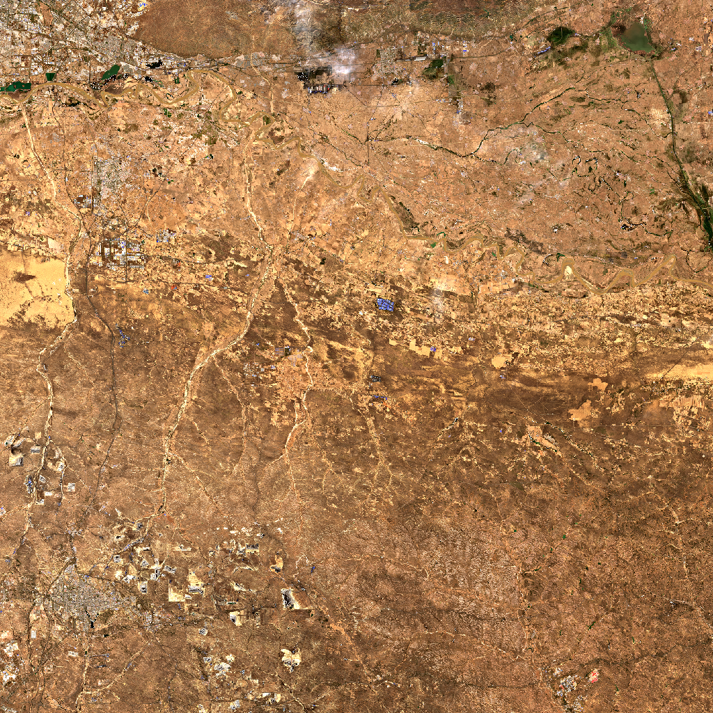
Sentinel-2 satellite preview of Kubuqi-Eastern-Dalad-Banner-region, captured on 2026-04-17 from an altitude of approximately 786 km.
Statement of Problem
Desertification threatens the livelihoods of over 2 billion people worldwide, degrading 12 million hectares of productive land annually. As climate change intensifies droughts and extreme weather events, arid and semi-arid regions face unprecedented ecological stress. In Kubuqi-Eastern-Dalad-Banner-region, the balance between sparse vegetation and expanding deserts hangs in the balance. Understanding vegetation health, soil exposure, and moisture stress is critical for guiding land restoration, sustainable grazing, and climate adaptation strategies. This analysis quantifies the current state of desert ecosystems in Kubuqi-Eastern-Dalad-Banner-region, identifies high-risk areas for desertification, and tracks 5-year trends to reveal whether the land is recovering or degrading.
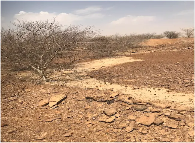
Landscape view of Kubuqi-Eastern-Dalad-Banner-region. Satellite-based monitoring helps track vegetation changes in arid and semi-arid regions worldwide.
Understanding Desert Ecosystems and Sparse Vegetation
The Global Importance of Drylands
Desert and semi-arid lands cover over 40 percent of the Earth's land surface and support the lives and livelihoods of more than 2 billion people. These landscapes may look empty from a distance, but they are deeply connected to food, water, and survival for millions. When land degrades in these regions, the effects travel far beyond the desert itself, impacting climate patterns, water cycles, and food security across continents.
The Challenge of Measuring Sparse Vegetation
Vegetation in desert regions behaves very differently from forests or farmlands. Most common satellite vegetation measures were created for places where plants grow thick and close together. In dry regions, plants are scattered and much of the ground is bare soil. This makes measurement tricky, because bare soil can sometimes reflect light in a way that looks like vegetation, even when there is very little growth.
To avoid this problem, desert monitoring uses vegetation measures that are adjusted for soil. Indices like SAVI and MSAVI2 are designed to reduce the effect of exposed soil and give a clearer picture of real plant growth. In this analysis for Kubuqi-Eastern-Dalad-Banner-region, we combine several vegetation and moisture indicators to understand different aspects of the landscape, including plant activity, greenness, and water stress. By looking at quarterly data over the past five years, we are not just seeing how the land looks today, but how it is changing over time. This helps us understand whether the land is slowly recovering or moving closer to degradation.
Executive Summary
Past (Last 5 Years)
Between 2021 and 2025, vegetation health in the Kubuqi-Eastern-Dalad-Banner region showed mixed trends. While some areas experienced recovery, others faced degradation. For instance, NDVI values increased from 0.13 in 2021 to 0.25 in 2025, indicating improved vegetation health. However, SAVI values fluctuated, with a low of 0.14 in 2026 compared to 0.37 in 2025, suggesting variable soil-adjusted vegetation conditions. Moisture stress, as indicated by NDMI, also varied, with values dropping from 0.99 in 2021 to 0.72 in 2025 before rising again to 0.96 in 2026.
Present (Current Status)
As of April 17, 2026, the Kubuqi-Eastern-Dalad-Banner region shows a complex vegetation landscape. The mean NDVI value is 0.116, indicating moderate vegetation health. However, SAVI values are higher at 0.174, suggesting better soil-adjusted vegetation conditions. Desertification risk remains a concern, with 80.18% of the area at low risk (0-0.2), 19.56% at moderate risk (0.2-0.4), and 0.26% at high risk (0.8-1.0). Areas with the most vegetation are concentrated in the eastern zones, while the northwestern areas show higher desertification risk.
Future (What Happens Next)
If current trends continue, the Kubuqi-Eastern-Dalad-Banner region may face increased desertification risks, particularly in areas already showing moderate to high risk. To mitigate this, targeted restoration efforts in high-risk zones, combined with the implementation of drought-resistant vegetation strategies, could help stabilize or reverse degradation. Continuous monitoring of moisture stress and vegetation health will be crucial to adapt strategies as needed.
1. Sparse Vegetation Assessment: SAVI vs NDVI
1.1 SAVI Analysis (Soil-Adjusted Vegetation Index)
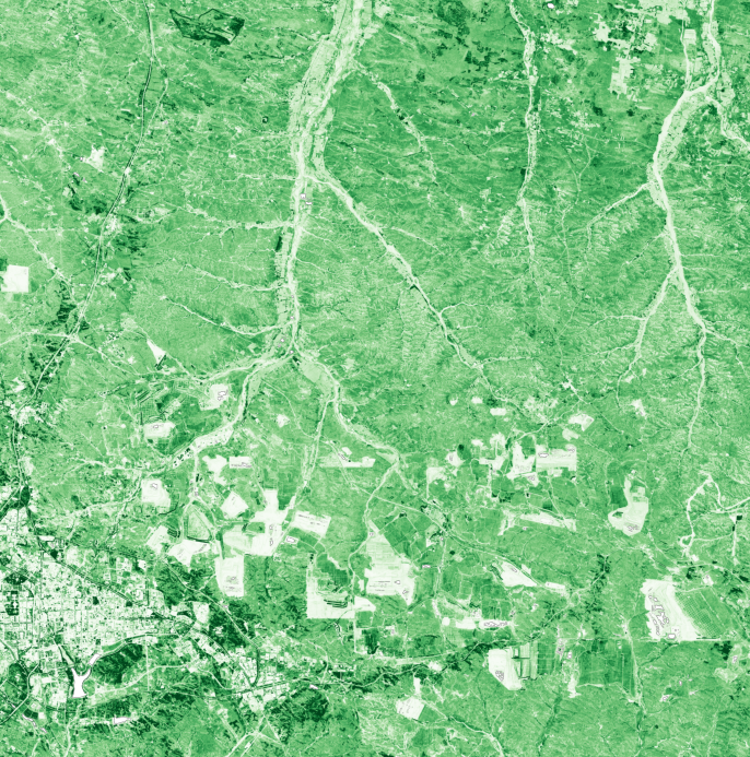
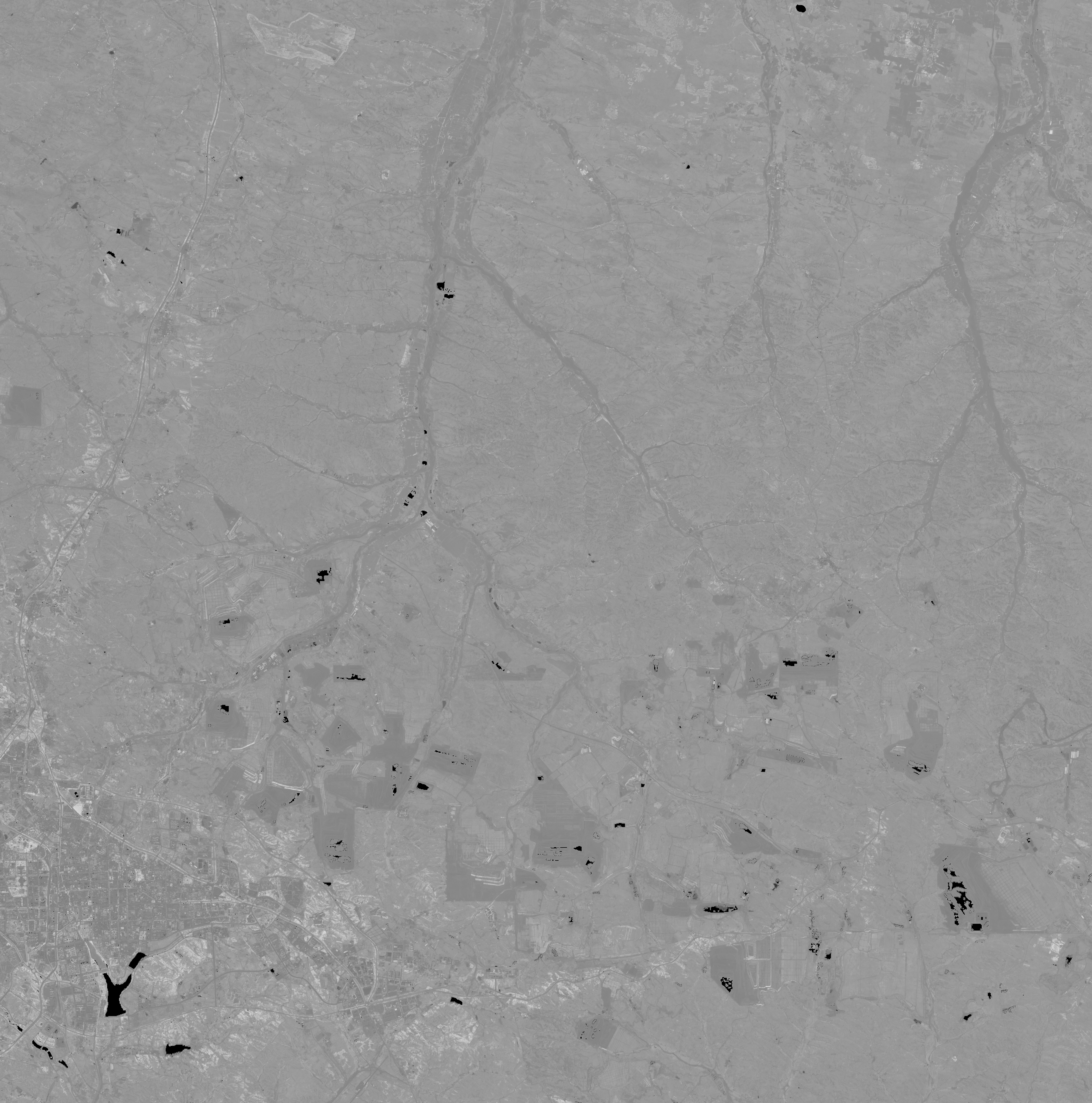
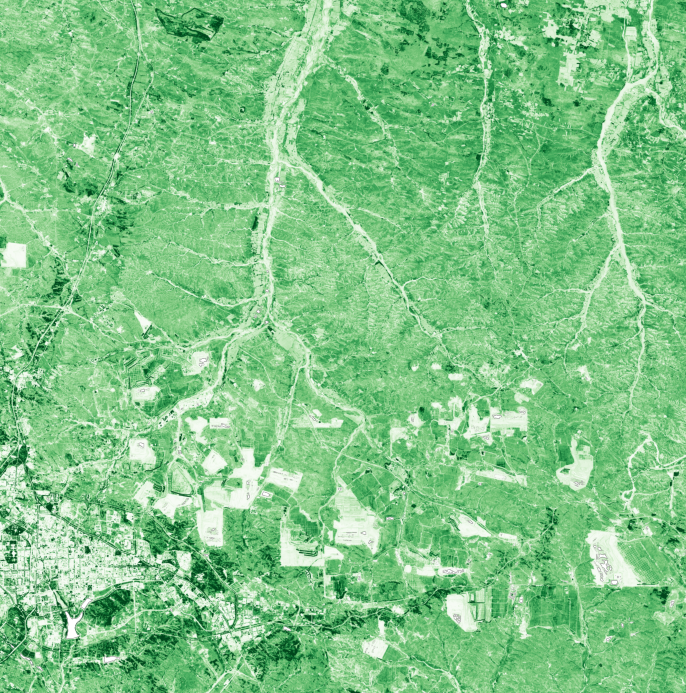
The SAVI analysis for the Kubuqi-Eastern-Dalad-Banner region reveals critical insights into vegetation health, especially in areas where soil brightness can skew standard vegetation indices. The mean SAVI value is 0.174, with a median of 0.178, indicating moderate soil-adjusted vegetation cover. The standard deviation of 0.064 suggests variability in vegetation conditions across the region. Spatial patterns show higher SAVI values in the eastern zones, indicating better vegetation health, while lower values in the west suggest sparser vegetation. The SAVI color and greyscale maps visually confirm these patterns, highlighting the importance of soil adjustment in accurately assessing vegetation in desert environments.
1.2 NDVI Analysis (Standard Vegetation Index)
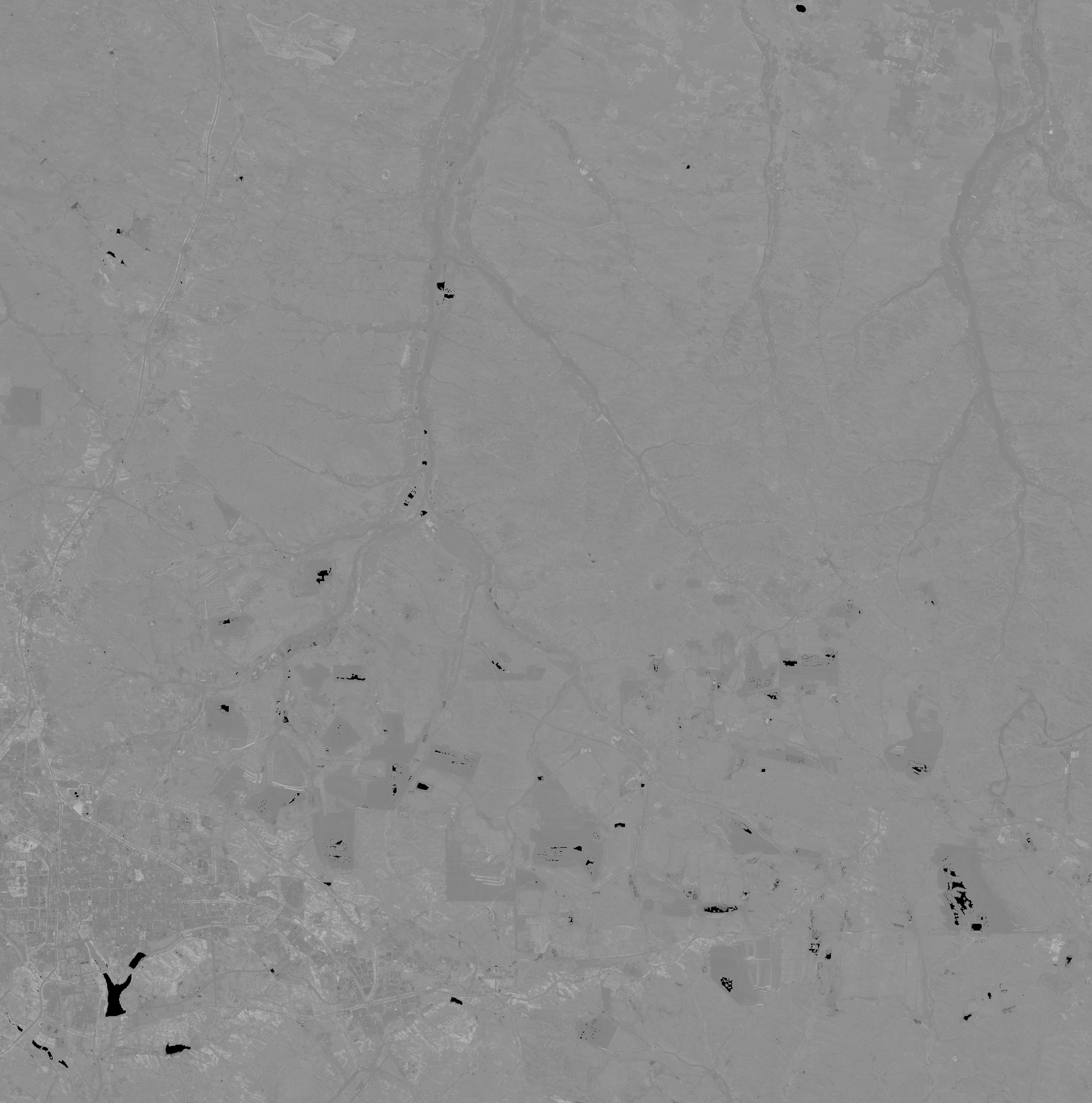
NDVI statistics for the region show a mean value of 0.116, with a median of 0.119, indicating moderate vegetation health. However, comparing NDVI with SAVI reveals limitations in using standard NDVI for sparse vegetation areas. NDVI tends to underestimate vegetation in bright soil conditions, as evidenced by the lower mean value compared to SAVI. The NDVI maps support this, showing less vegetation cover than the SAVI maps, particularly in the western zones where soil brightness is higher.
1.3 SAVI vs NDVI: Why Soil Adjustment Matters
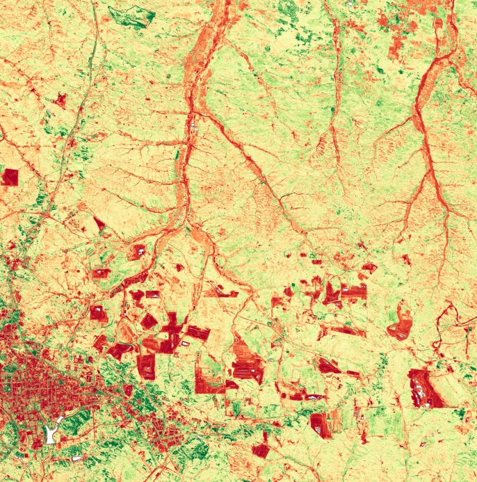
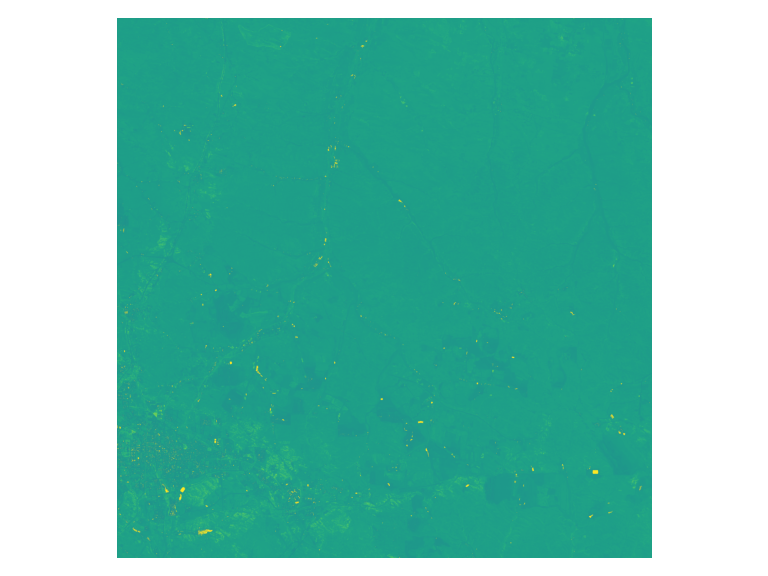
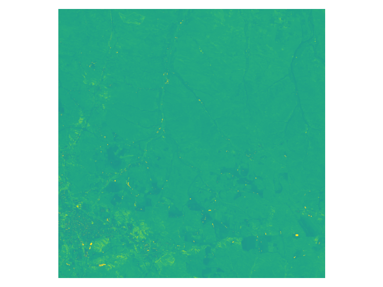
The difference bins between SAVI and NDVI highlight where soil adjustment reveals vegetation that NDVI misses due to soil brightness. Over 95% of the region falls into the bin where SAVI values are between -0.001 and 0.095, indicating that SAVI detects more vegetation in these areas. This is particularly evident in the northwestern zones, where NDVI shows sparse vegetation, but SAVI indicates a more robust vegetation cover. The SAVI-NDVI difference map and legend visually demonstrate these discrepancies, underscoring the importance of soil adjustment in accurately assessing vegetation in desert regions.
SAVI Color Visualization (Soil-Adjusted)
SAVI Greyscale (Index Values)
NDVI Color Visualization (Standard)
NDVI Greyscale (Index Values)
SAVI-NDVI Difference Map (Shows where soil adjustment reveals hidden vegetation)
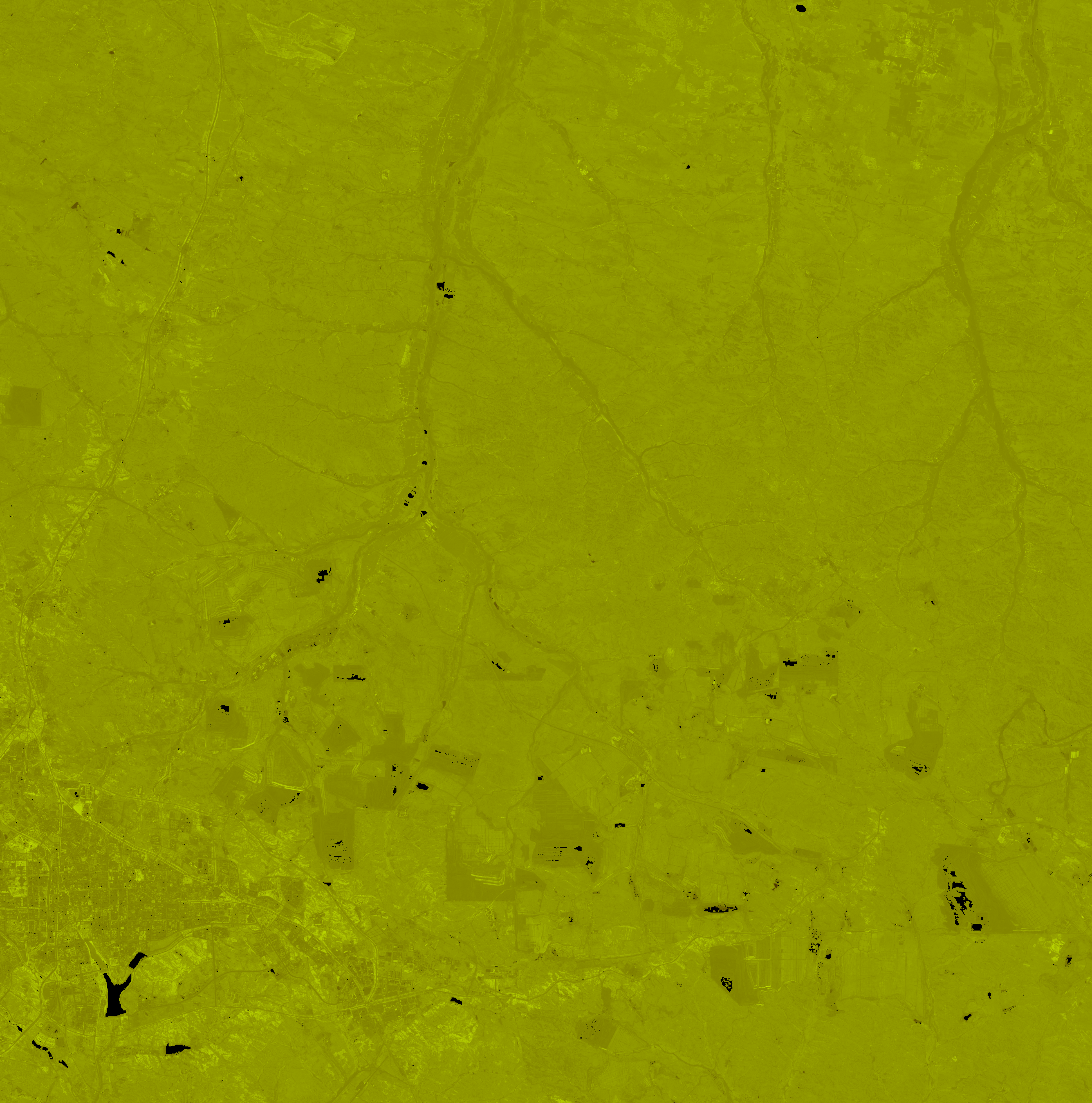
Combined SAVI-NDVI Overlay
2. Desertification Risk Analysis
2.1 Risk Zone Distribution
The desertification risk bins analysis identifies three main risk zones in the Kubuqi-Eastern-Dalad-Banner region. Approximately 80.18% of the area is at low risk (0-0.2), 19.56% is at moderate risk (0.2-0.4), and 0.26% is at high risk (0.8-1.0). High-risk zones are primarily located in the northwestern areas, where soil exposure and degradation are most pronounced. Factors contributing to high risk include prolonged drought, overgrazing, and unsustainable land use practices. The desertification risk map and legend visually depict these zones, highlighting the urgent need for targeted interventions in the high-risk areas.
2.2 Geographic Patterns & Critical Areas
Spatial patterns of desertification risk show that the most vulnerable areas are in the northwestern corridors, where degradation is most severe. These corridors act as pathways for the spread of desertification, threatening adjacent zones. The overlay visualization confirms these patterns, indicating that restoration efforts should prioritize these critical areas to prevent further degradation and promote recovery.
2.3 Key Findings from Dashboard
- Mean desertification risk: 0.183
- 80.18% of the region at low risk (0-0.2)
- 19.56% of the region at moderate risk (0.2-0.4)
- 0.26% of the region at high risk (0.8-1.0)
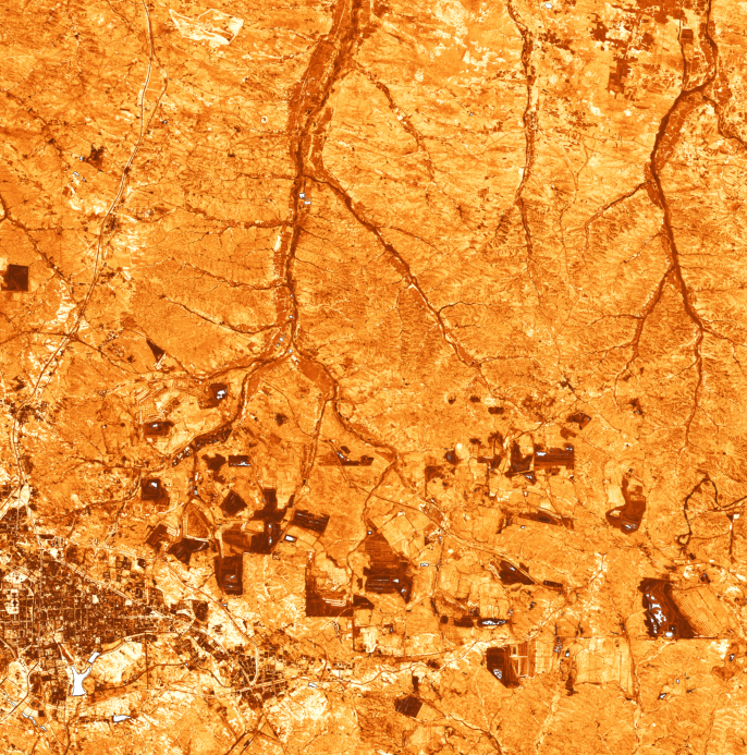
Desertification Risk Map (Red = high risk zones requiring intervention)
5-Year Vegetation Trends (2021-2026)
Quarterly satellite observations reveal how vegetation and moisture levels have changed over the past 5 years. These trends help identify long-term degradation or recovery patterns.
NDVI vs SAVI Trends
Quarterly mean NDVI and SAVI values showing seasonal cycles and long-term trends.
Vegetation Moisture Stress (NDMI)
NDMI tracks vegetation water content. Lower values indicate moisture stress.
5-Year Change Summary
- NDVI Change: -0.029 (2021-04-18 to 2026-01-12)
- SAVI Change: -0.050 (soil-adjusted vegetation)
- NDMI Change: -0.039 (moisture stress indicator)
Note: Positive changes indicate vegetation recovery. Negative changes suggest degradation or drought stress.
3. Vegetation Health & Moisture Stress
3.1 Enhanced Vegetation Index (EVI)
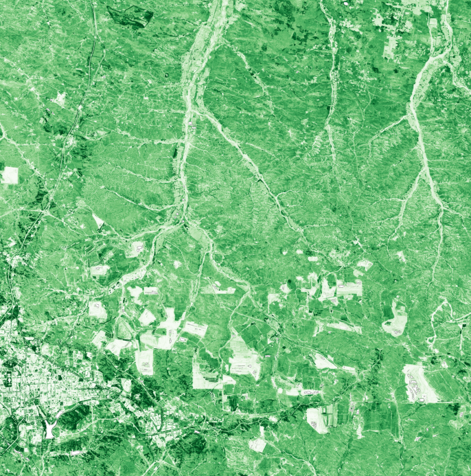
The EVI statistics for the Kubuqi-Eastern-Dalad-Banner region show a mean value of 0.305, with a median of 0.304, indicating robust vegetation health when corrected for atmospheric conditions and canopy background. EVI improves on NDVI by providing a more accurate representation of vegetation in areas with varying atmospheric conditions and soil backgrounds. Spatial patterns show higher EVI values in the eastern zones, similar to SAVI, but with more pronounced differences in areas with dense vegetation. The EVI map visually confirms these patterns, highlighting the benefits of using EVI in desert environments.
3.2 Moisture Stress Assessment (NDMI & MSAVI2)
NDMI and MSAVI2 statistics provide critical insights into moisture stress in the region. The mean NDMI value is -0.120, indicating moderate moisture stress, while the mean MSAVI2 value is 0.206, suggesting better soil-adjusted vegetation conditions. Lower NDMI values indicate drought-stressed areas, particularly in the western zones where moisture levels are critically low. MSAVI2 further refines these assessments by accounting for soil brightness, showing more robust vegetation in areas where NDMI indicates stress. The NDMI and MSAVI2 maps visually depict these patterns, identifying moisture-stressed areas that require urgent attention.
3.3 Chlorophyll Content (NDRE)
NDRE statistics reveal critical information about chlorophyll content in the sparse vegetation of the Kubuqi-Eastern-Dalad-Banner region. The mean NDRE value is 0.073, with a median of 0.077, indicating moderate chlorophyll content. Lower NDRE values suggest vegetation stress or senescence, particularly in the western zones where vegetation is sparser. The NDRE map visually confirms these patterns, highlighting areas where vegetation health is compromised due to low chlorophyll content.
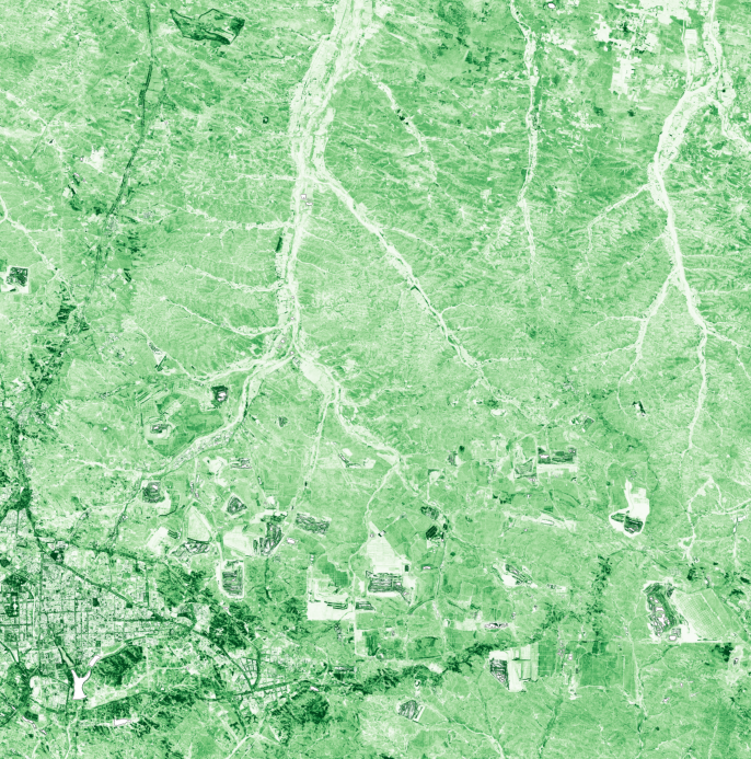
EVI (Enhanced Vegetation Index)
MSAVI2 (Modified SAVI)
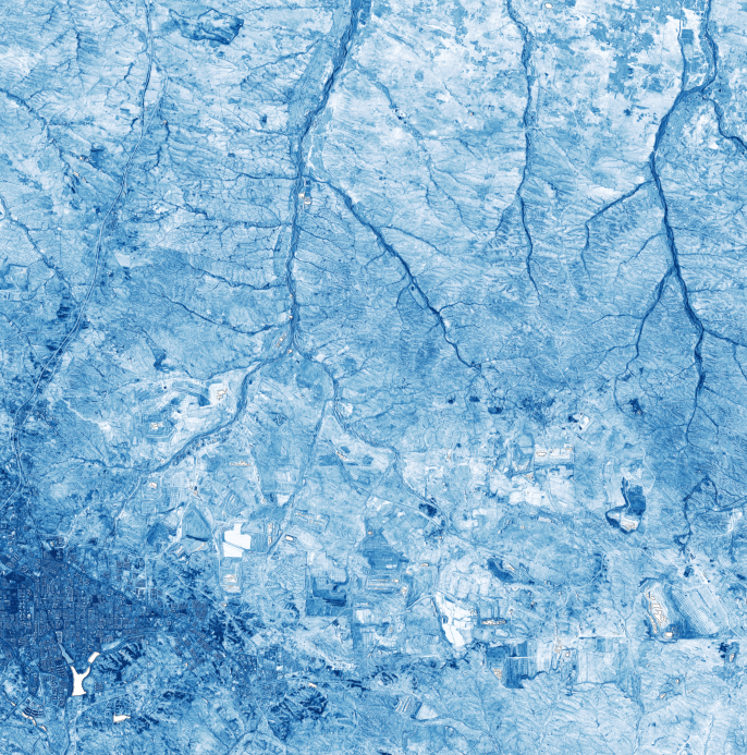
NDMI (Moisture Stress)
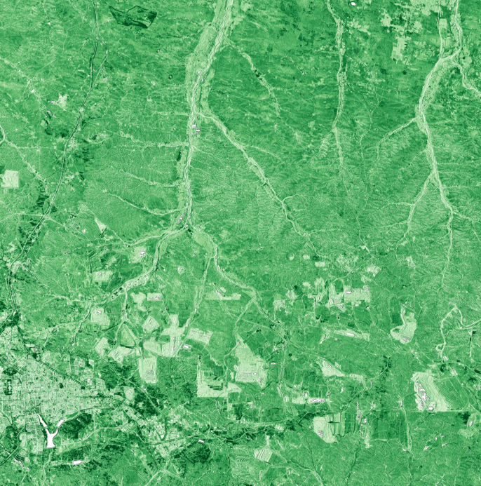
NDRE (Chlorophyll Content Indicator)
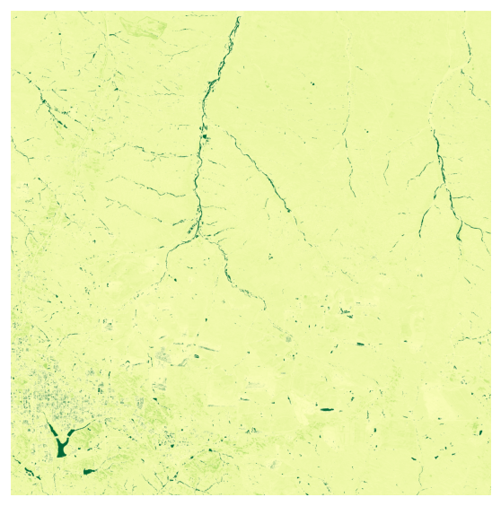
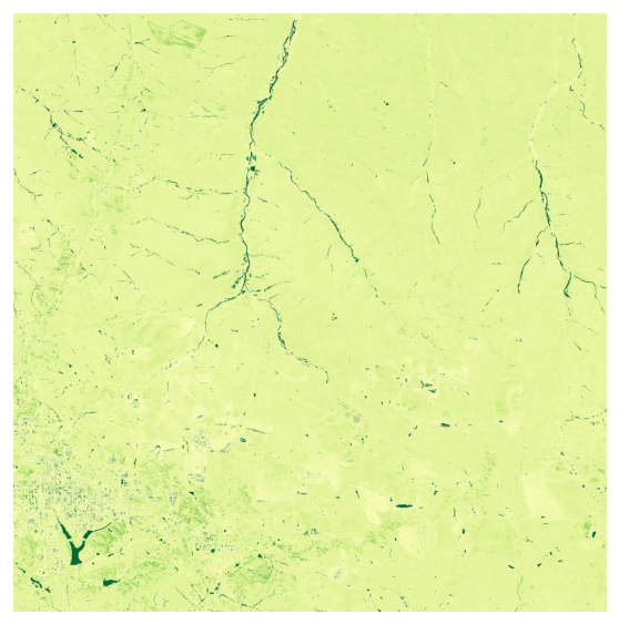
Visual Comparison: 2021 vs 2026
Side-by-side comparisons show spatial patterns of vegetation change over 5 years. Green areas indicate vegetation; brown/red areas indicate bare soil or sparse vegetation.
NDVI: 2021 Q2 vs 2026 Q1
2021 Q2 (Baseline)
2026 Q1 (Current)
SAVI: 2021 Q2 vs 2026 Q1
2021 Q2 (Baseline)
2026 Q1 (Current)
Visual Analysis: Compare green (vegetation) vs brown/red (bare soil) areas. Areas shifting from brown to green indicate recovery; green to brown indicates degradation.
4. Long-Term Trends & Land Management Recommendations
4.1 5-Year Trends (2021-2025)
Analyzing the historical quarterly data from 2021 to 2025 reveals mixed trends in vegetation health and moisture stress in the Kubuqi-Eastern-Dalad-Banner region. NDVI values showed an overall increase from 0.13 in 2021 to 0.25 in 2025, indicating improved vegetation health. However, SAVI values fluctuated, with a low of 0.14 in 2026 compared to 0.37 in 2025, suggesting variable soil-adjusted vegetation conditions. Moisture stress, as indicated by NDMI, also varied, with values dropping from 0.99 in 2021 to 0.72 in 2025 before rising again to 0.96 in 2026. These trends highlight the region's vulnerability to seasonal variability and the need for continuous monitoring and adaptive management strategies.
4.2 What's Working Well
- Areas showing vegetation recovery, as indicated by increasing NDVI values from 2021 to 2025.
- Stable moisture levels in certain zones, as evidenced by consistent NDMI values in specific areas.
4.3 Critical Challenges
- Expanding desertification risk zones, particularly in the northwestern areas where risk levels have increased.
- Declining vegetation in specific areas, as indicated by fluctuating SAVI values.
- Increasing moisture stress, particularly in the western zones where NDMI values have dropped significantly.
4.4 Evidence-Based Recommendations
- Prioritize restoration efforts in high-risk zones identified in Section 2 to prevent further degradation.
- Implement drought-resistant vegetation in moisture-stressed areas identified in Section 3 to enhance resilience.
- Continuously monitor areas showing declining trends in historical data to adapt strategies as needed.
Why These Indices Matter for Deserts
Core Indices for Desert Analysis
Desert ecosystems require specialized remote sensing approaches that account for sparse vegetation and high soil reflectance. This analysis uses six complementary indices:
Understanding SAVI and Soil Adjustment
SAVI (Soil-Adjusted Vegetation Index) was specifically developed for areas with sparse vegetation. It includes a soil brightness correction factor (L=0.5) that reduces the influence of exposed soil on vegetation measurements. In deserts, SAVI values typically range from 0.1 to 0.4, with higher values indicating denser vegetation patches. SAVI is more reliable than NDVI in arid regions where vegetation cover is less than 40%.
MSAVI2 (Modified Soil-Adjusted Vegetation Index) improves on SAVI by using a variable soil adjustment factor that adapts to different soil brightnesses. This makes it more accurate across diverse desert landscapes with varying soil types.
Standard and Enhanced Vegetation Indices
NDVI (Normalized Difference Vegetation Index) measures the difference between near-infrared and red light reflectance. While less reliable in deserts due to soil contamination, NDVI is included for comparison and to maintain consistency with global vegetation monitoring standards. Typical desert NDVI ranges: 0.1-0.2 = bare soil with scattered vegetation; 0.2-0.4 = sparse vegetation; >0.4 = moderate vegetation.
EVI (Enhanced Vegetation Index) corrects for atmospheric conditions and canopy background noise, making it more sensitive in areas with moderate vegetation. EVI is particularly useful for detecting subtle changes in vegetation health that NDVI might miss.
Moisture and Stress Indicators
NDMI (Normalized Difference Moisture Index) measures vegetation water content by comparing near-infrared and shortwave infrared reflectance. In deserts, NDMI is a critical early warning indicator: declining NDMI values signal drought stress before visible browning occurs. Values <0 indicate severe moisture stress; 0-0.2 = moderate stress; >0.2 = adequate moisture.
NDRE (Normalized Difference Red Edge) uses the red edge band (Band 5) to measure chlorophyll content. It is highly sensitive to vegetation stress in sparse canopies and can detect early senescence (aging/dying vegetation) before it appears in standard indices.
Desertification Risk Assessment
The Desertification Risk Index is a composite metric that combines vegetation indices, soil exposure, and moisture stress to identify areas at high risk of land degradation. High-risk zones (typically where SAVI < 0.15 and NDMI < 0) require immediate intervention to prevent irreversible desertification.
Data & Methods
Data Sources
- Satellite: Sentinel-2C Level-2A (atmospherically corrected)
- Provider: Microsoft Planetary Computer
- Observation Date: 2026-04-17
- Cloud Cover: 2.328151%
- Spatial Resolution: 10 meters (NDVI, SAVI, EVI), 20 meters (NDMI, MSAVI2, NDRE, resampled to 10m)
Index Calculations
- NDVI = (NIR - Red) / (NIR + Red) using Bands 8 and 4
- SAVI = ((NIR - Red) / (NIR + Red + L)) × (1 + L), where L = 0.5 (soil brightness correction factor)
- MSAVI2 = (2×NIR + 1 - √((2×NIR + 1)² - 8×(NIR - Red))) / 2
- EVI = 2.5 × ((NIR - Red) / (NIR + 6×Red - 7.5×Blue + 1))
- NDMI = (NIR - SWIR1) / (NIR + SWIR1) using Bands 8 and 11
- NDRE = (NIR - RedEdge) / (NIR + RedEdge) using Bands 8 and 5
- SAVI-NDVI Difference = SAVI - NDVI (reveals soil adjustment impact)
- Desertification Risk = Composite metric combining low vegetation, high soil exposure, and moisture stress
Historical Trend Analysis
This analysis includes 5 years of quarterly satellite observations (2021-2025), providing
20 data points for trend analysis. Quarterly observations capture seasonal variability
(wet/dry seasons) and long-term degradation or recovery patterns. Historical data is
stored at: trees-and-data/greenery-monitoring-past-data/ with quarterly
folders (Q1: January, Q2: April, Q3: July, Q4: October).
Processing Workflow
Images were processed using Python with the pystac-client and rasterio
libraries. Cloud masking was applied using the Scene Classification Layer (SCL). Statistics
were computed using rasterio zonal statistics and exported as JSON for
analysis. All geospatial outputs are provided as Cloud-Optimized GeoTIFFs (COGs) for
efficient web access and GIS integration.
Limitations & Considerations
- Analysis represents quarterly snapshots; higher temporal resolution would capture intra-seasonal dynamics
- Cloud cover and atmospheric conditions affect image quality, especially during monsoon seasons
- 10-meter resolution may not capture individual shrubs or small vegetation patches
- Study area boundaries reflect the satellite image crop, not administrative boundaries
- Soil-adjusted indices (SAVI, MSAVI2) assume moderate soil brightness; extreme soil types (white salt flats, black basalt) may require calibration
- Desertification risk is inferred from spectral indices; ground validation recommended for restoration planning
- Historical trends assume consistent processing methods; changes in Sentinel-2 calibration over time are minimal but not zero
Download Data & Maps
Images & Visualizations
- NDVI Color Map (PNG)
- SAVI Color Map (PNG)
- MSAVI2 Color Map (PNG)
- EVI Color Map (PNG)
- NDMI Color Map (PNG)
- NDRE Color Map (PNG)
- SAVI-NDVI Difference Map (PNG)
- Difference Map Legend (PNG)
- Desertification Risk Map (PNG)
- Risk Map Legend (PNG)
- Combined Overlay (PNG)
Geospatial Data (Cloud-Optimized GeoTIFFs)
- NDVI GeoTIFF (COG)
- SAVI GeoTIFF (COG)
- MSAVI2 GeoTIFF (COG)
- EVI GeoTIFF (COG)
- NDMI GeoTIFF (COG)
- NDRE GeoTIFF (COG)
- Difference GeoTIFF (COG)
- Risk GeoTIFF (COG)
Statistical Data
README Note
Our Mission: We want this research dataset brief to be Simple, Authentic, and Repeatable.
1. Title of the Dataset
Desert Greening & Desertification Risk Assessment
2. What This Dataset Is About
This dataset was created to help anyone understand how vegetation and green cover in this region is changing over time. It brings together processed satellite data, simple calculations, and a few observations that give the bigger picture.
3. Why This Dataset Matters
At I Hug Trees, we believe that Geospatial Satellite imagery and processed data should be accessible
to everyone. While grounded in scientific principles, outputs are presented in accessible formats so
that technical imagery and calculations resonate with ordinary people and communities.
Because only
when it is relatable, can it tell clear stories about our greenery and urban life: shaping how we
live, how we breathe, and how we cope with rising heat.
This dataset tries to make that easier. Whether you are a researcher, policy maker, student or just curious about the environment, these numbers and images help you see trends that are not obvious at first glance.
4. Source of the Data
- Satellite: Sentinel-2
- Provider: Microsoft Planetary Computer
- Acquisition Window: Past 60 days (filtered by cloud cover)
- Cloud Cover Threshold: < 30%
- Initial Tile Discovery: Copernicus Data Space Ecosystem browser
5. How the Data Was Processed
Basic Preprocessing:
It is important to get the right tile from the Sentinel-2 database for imagery processing. The browser feature from the Copernicus Data Space Ecosystem helped us identify the correct tile, its bounds, and the subset coordinates needed for extraction. It is always essential to double-check the preview image to verify that the fetched tile truly corresponds to the target region.
Next, we used an AWS Lambda environment for the bounds-discovery phase. This step involved fetching band data from the Microsoft Planetary Computer for dates where cloud cover was below 30% within the past 60 days. Once the acquisition date met this condition, we moved to AWS EC2 server scripts written in Python to download raw band data and process them into COGs (Cloud Optimised GeoTIFFs) along with additional indices.
These processed COGs and index outputs are then used for image displays, NDVI interpretation, and HTML digest features published on our platform. All indices raw value outputs are in JSON files for easy repeatable processing. We currently run this workflow on a quarterly schedule for each identified region.
Cloud Masking:
This dataset uses Sentinel-2's Scene Classification Layer (SCL) to remove pixels affected by clouds, shadows, haze, and saturation. Only surface-clear classes are kept, ensuring that the vegetation indices are calculated from clean, reliable pixels. The masking is applied at the pixel level, meaning every index (NDVI, EVI, etc.) is computed only on valid areas after stripping away noisy regions. This results in more trustworthy COGs, cleaner previews, and more meaningful temporal comparisons.
Calculation Formulas Used:
NDVI = (NIR − Red) ÷ (NIR + Red)EVI = 2.5 × (NIR − Red) ÷ (NIR + 6×Red − 7.5×Blue + 1)NDWI = (Green − NIR) ÷ (Green + NIR)SAVI = (NIR − Red) ÷ (NIR + Red + L) × (1 + L)MSAVI2 = [2×NIR + 1 − √((2×NIR + 1)² − 8×(NIR − Red))] ÷ 2
Tools Used:
Data Source: Microsoft Planetary Computer (Sentinel-2 L2A), rasterio, GDAL
Computation: Python 3, NumPy, SciPy, Pillow, Rasterio, rio-cogeo
AWS Pipeline: Lambda (triggers), EC2 (processing), S3 (storage), Bedrock (AI summaries)
Mapping: Leaflet.js, tile layers served from S3
Automation: Python boto3, Cron (EC2 quarterly jobs)
6. File Contents
The dataset includes metadata.json with satellite tile information, various index outputs
(NDVI, EVI, NDWI, NDBI, MNDWI, NDMI), and statistical summaries. Please find the detailed list of files
available for download in the Download Data & Maps section below.
7. How to Use This Dataset
You can explore the NDVI trends, plug the json file into your favourite tool, build visualisations, or compare it with earlier datasets. It's created to be flexible.
8. Leveraging AI
AI helped speed up some parts of the work, like spotting unusual patterns, creating brief insights, and checking for inconsistencies. All metadata and bin-statistics JSON files were loaded and parsed into structured dictionaries, ensuring the AI receives clean, context-rich inputs for stable summarisation and interpretation.
9. Limitations & Things to Keep in Mind
- Cloud cover may affect accuracy
- NDVI has known limitations
- Spatial resolution is 10 meters
- Some patterns may need ground truth validation
10. License / Permissions
Please refer to the How to Cite This Analysis section below for citation guidelines. This dataset is licensed under Creative Commons Attribution 4.0 International (CC BY 4.0).
11. Contact
For any questions, collaborations, or clarifications, feel free to reach out at: nature@ihugtrees.org
How to Cite This Analysis
Recommended Citation
Yaragarla, R. (2026). Desert Greening & Desertification Risk Assessment: Kubuqi-Eastern-Dalad-Banner-region. I Hug Trees. Retrieved from https://ihugtrees.org/trees-and-data/desert-greening/Kubuqi-Eastern-Dalad-Banner-region/2026/04/27/digest.html
Satellite data: Copernicus Sentinel-2 (ESA), processed via Microsoft Planetary Computer.
BibTeX Entry
@misc{ihugtrees_desert_kubuqieasterndaladbannerregion_2026,
author = {Yaragarla, Ramkumar},
title = {Desert Greening \& Desertification Risk Assessment: Kubuqi-Eastern-Dalad-Banner-region},
year = {2026},
publisher = {I Hug Trees},
url = {https://ihugtrees.org/trees-and-data/desert-greening/Kubuqi-Eastern-Dalad-Banner-region/2026/04/27/digest.html},
note = {Satellite data: Copernicus Sentinel-2}
}
License
This analysis and associated datasets are licensed under Creative Commons Attribution 4.0 International (CC BY 4.0). You are free to share and adapt this work with appropriate attribution.
Planetary Computer Citation
If using Microsoft Planetary Computer data, please cite: microsoft/PlanetaryComputer (2022)